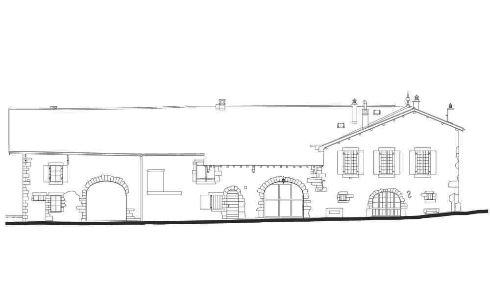
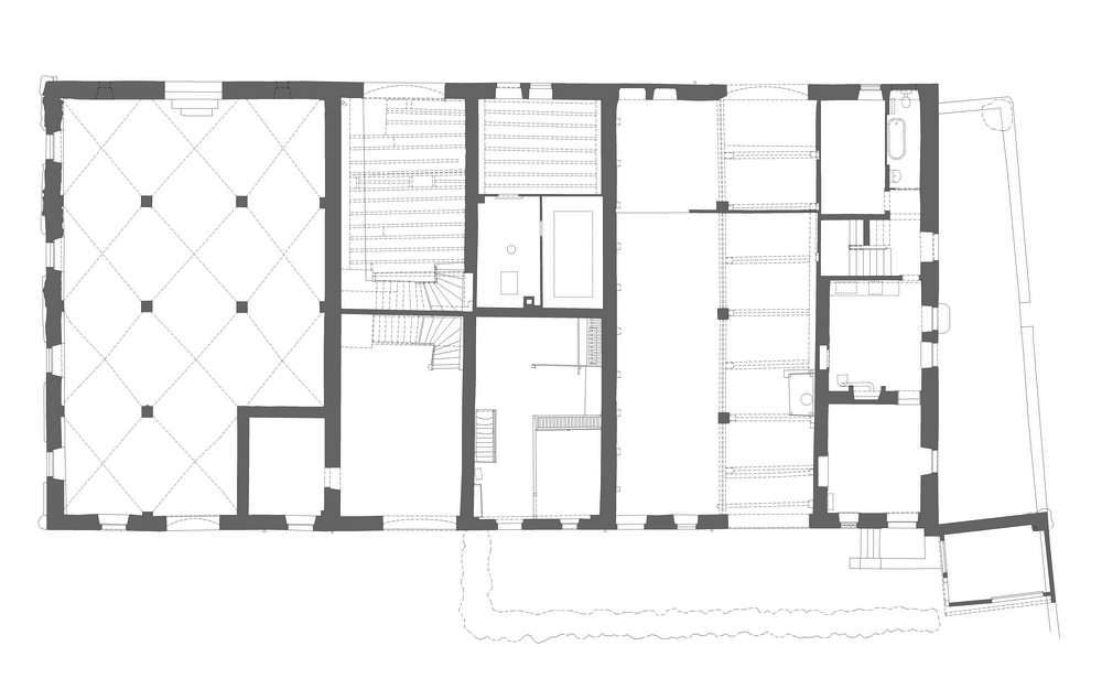
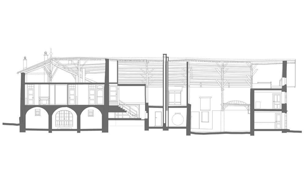
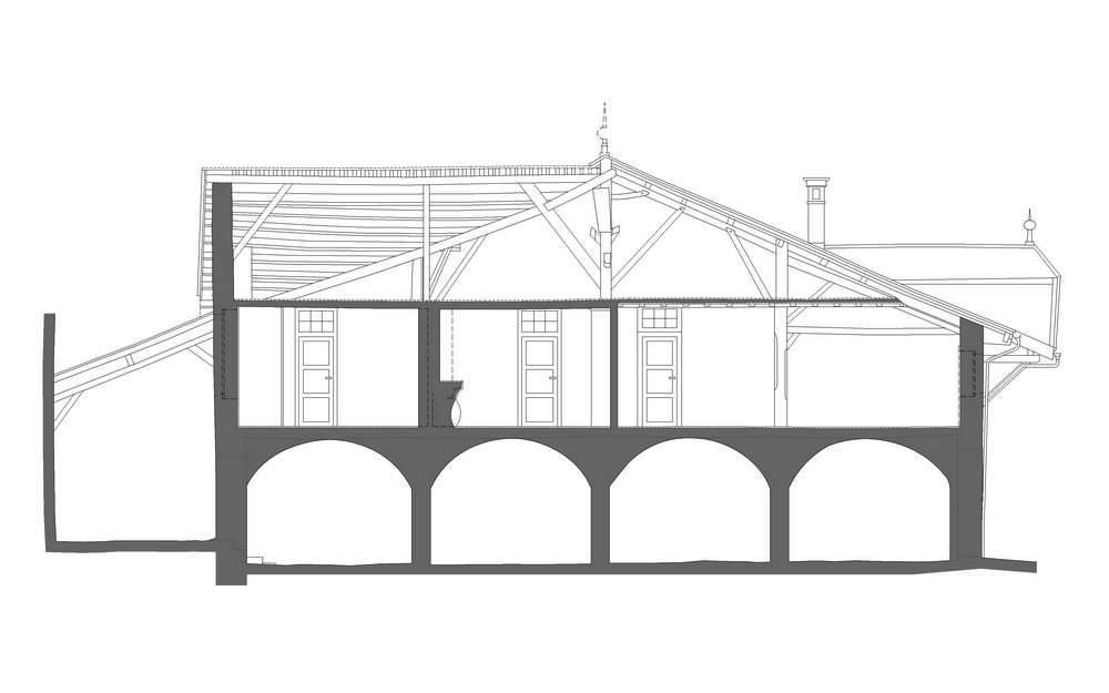
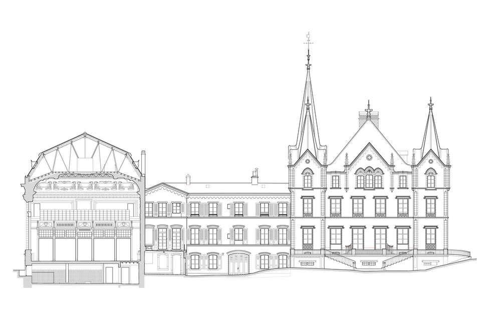
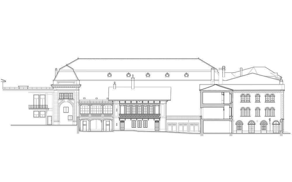
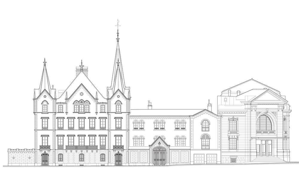
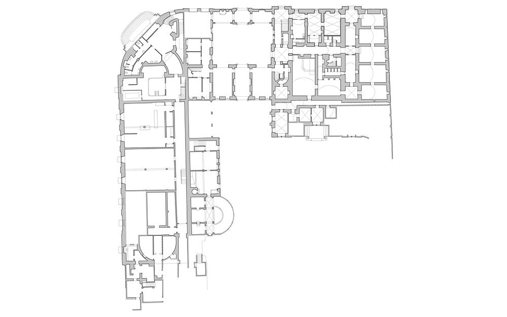
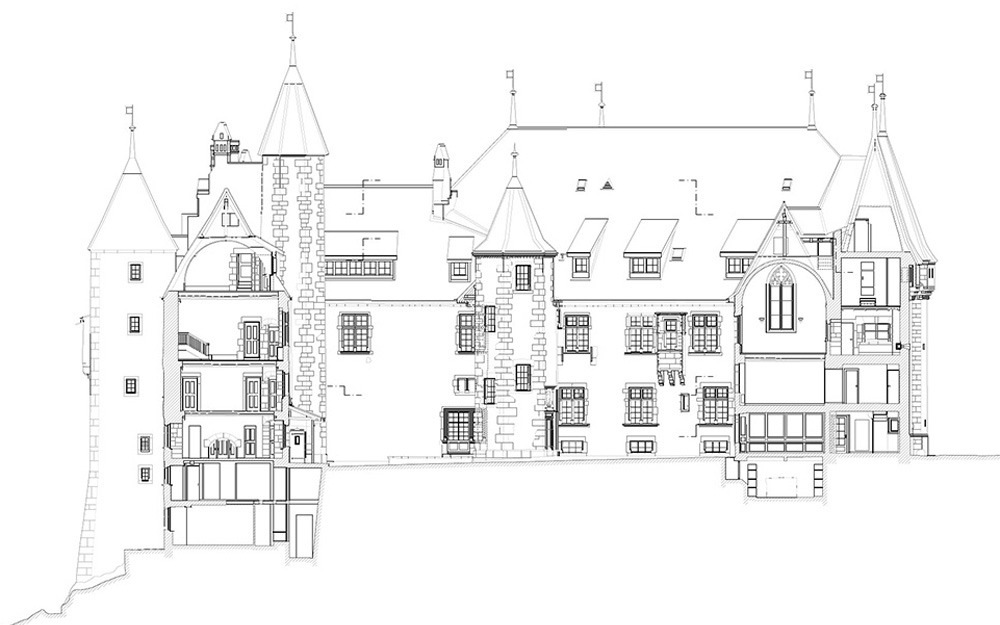
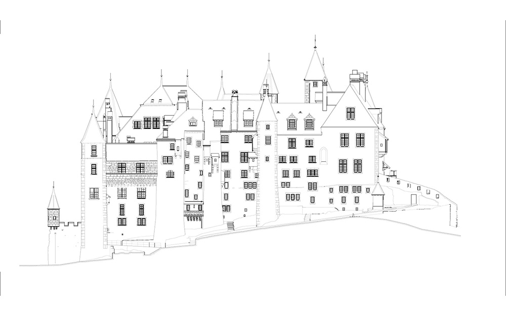
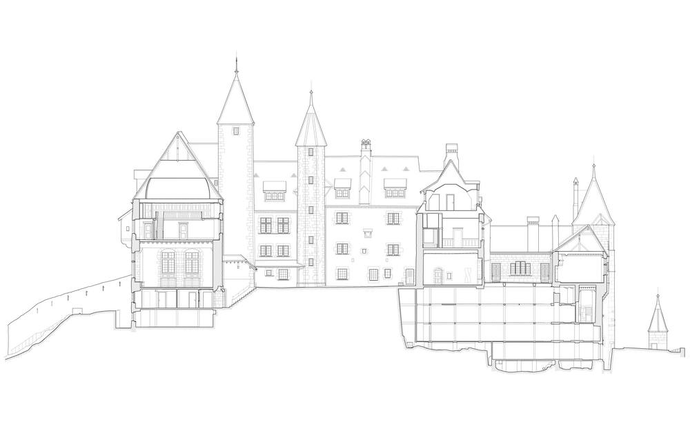
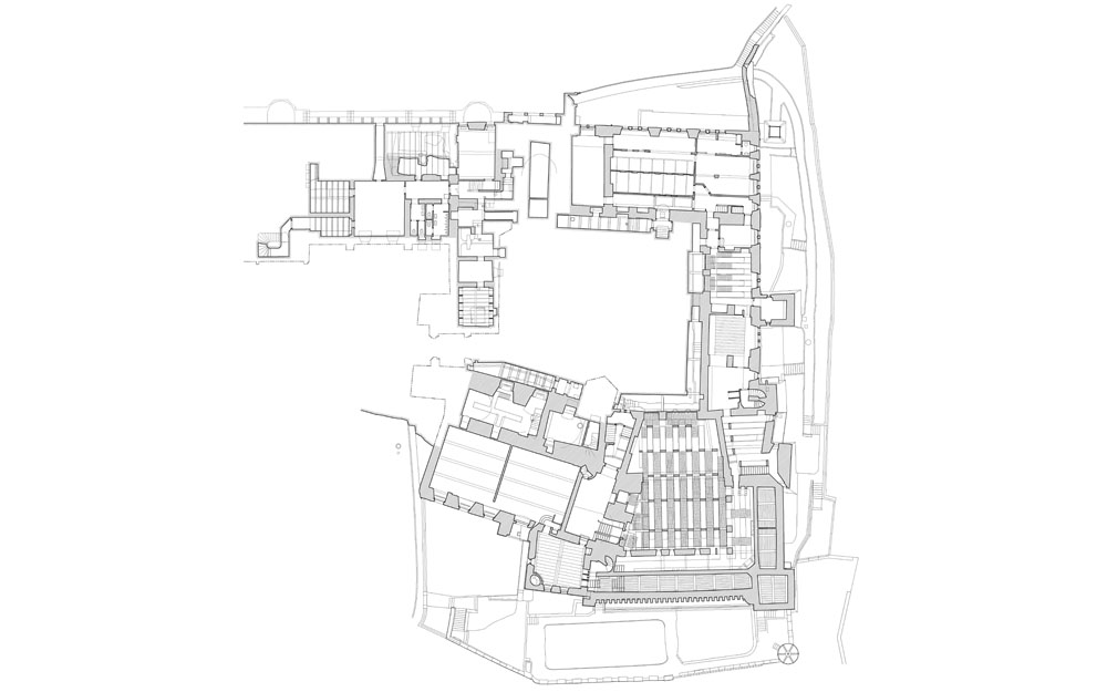
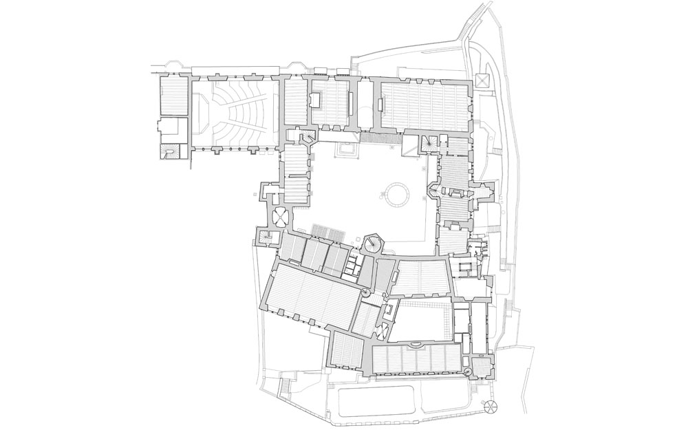
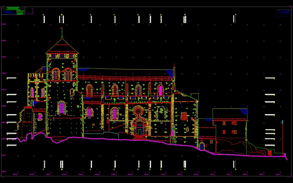
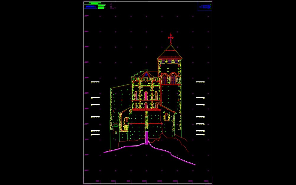
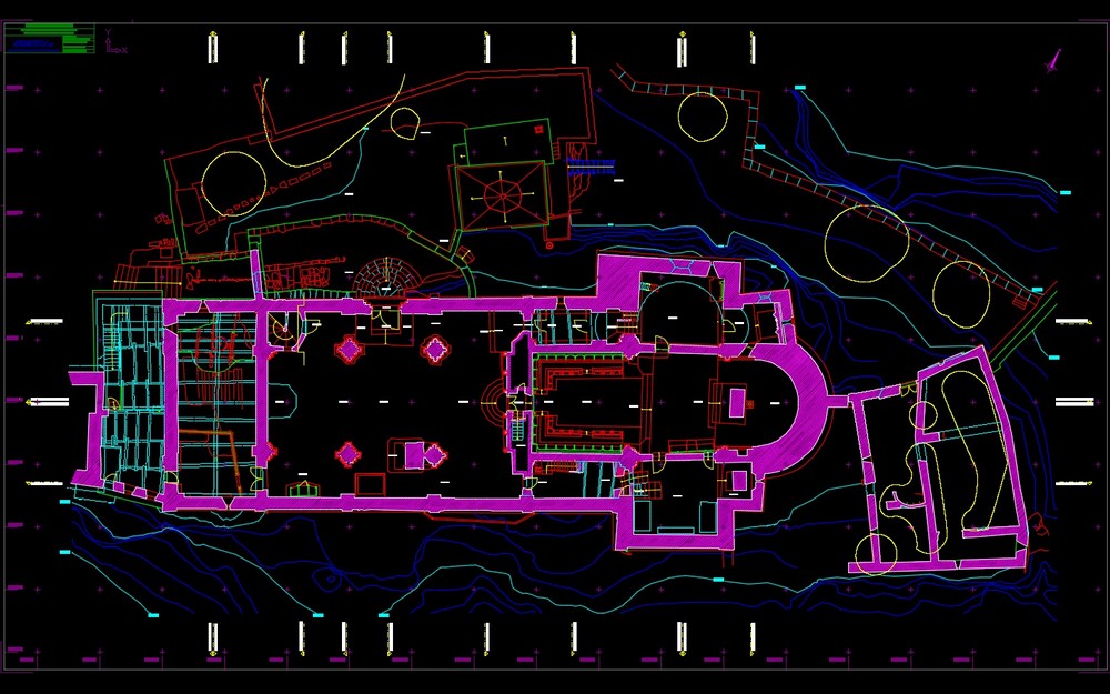
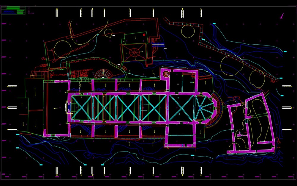
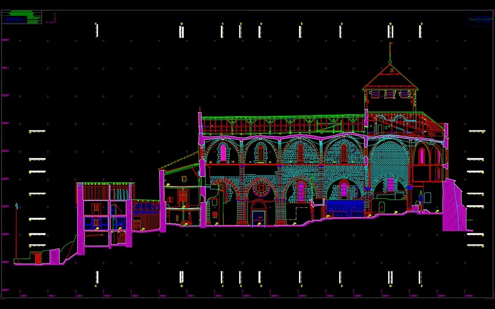
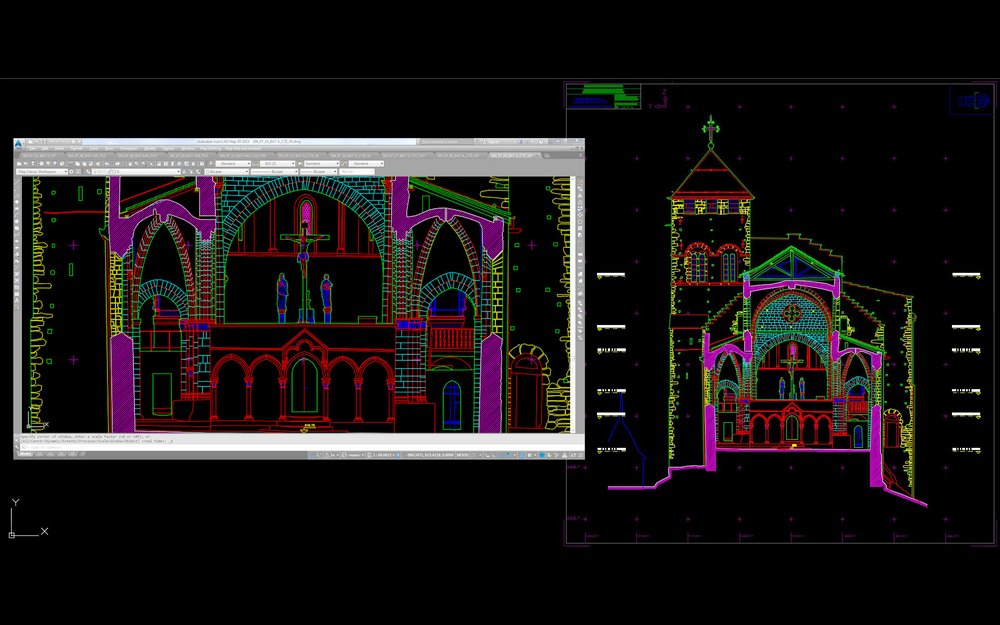
Structured 2D vector plans
With the data issued from laser scanning and/or photogrammetry, we proceed to the vectorial edition structured by materials of the digitized building’s plans, cross-sections and elevations. This work helps build coherent documents in which the artefacts located in the captured scenes are eliminated. The exact correlation between the plans, the cross-sections and the elevations is rigorously inspected as well from a geometrical perspective as on the coherence of the presented details.
The perspectives of the documentary shootings produced during the survey, as well as the position of every digitizing station are georeferenced on the building’s or the site’s plans.
Digitization service for paper documents
Using the document scanner CONTEX, Archéotech SA can digitize every type of plans up to formats of 1 by 14 metres. A fast and efficient service of vectorization guarantees their transformation to be used in traditional DAO systems.